


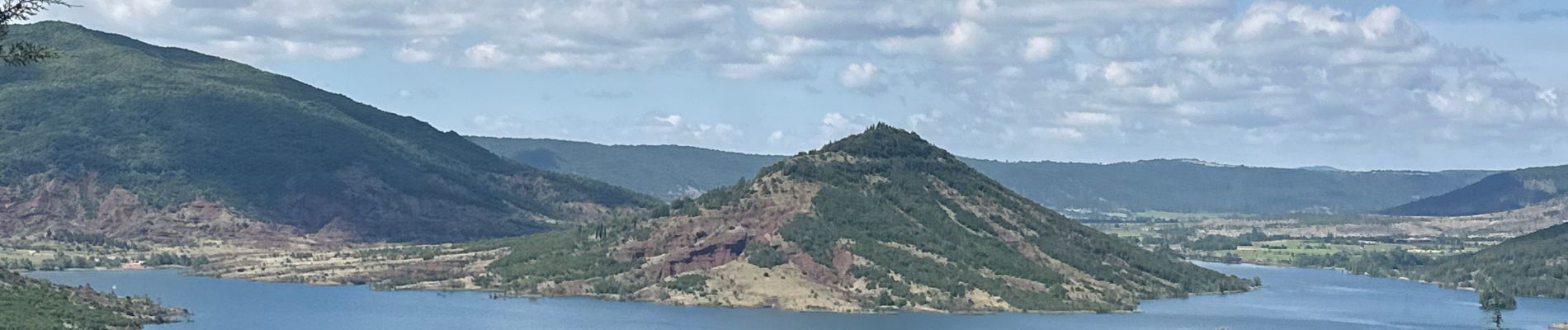
Les Vailhès lac de Salagou

alinetpierre
User
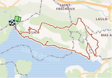

Length
13.5 km

Max alt
301 m

Uphill gradient
251 m
Km-Effort
16.8 km

Min alt
136 m

Downhill gradient
256 m
Boucle
No
Creation date :
2024-06-04 05:52:17.0
Updated on :
2024-06-04 11:15:02.925

FREE GPS app for hiking
 SityTrail
IGN / Geographical institutes
SityTrail Plus
The world is yours!
About
Trail of 13.5 km to be discovered at Occitania, Hérault, Le Puech. This trail is proposed by alinetpierre.
Description
Belle randonnée, avec une extension sur le plateau pour admirer des bories.
Photos


Positioning
Country:
France
Region :
Occitania
Department/Province :
Hérault
Municipality :
Le Puech
Location:
Unknown
Start:(Dec)
Start:(UTM)
528557 ; 4835334 (31T) N.
Comments